
Tropical Storm Erika Enters the Caribbean
Tropical Storm Erika, the 5th named storm of the season, entered the northeast Caribbean early this morning as it passed through the Leeward Islands between Guadeloupe and Antigua. Fortunately, there were no reports of damage thanks in part to the effects of inhibiting wind shear, which kept the storm from strengthening. Erika originated as a wave of low pressure that was first detected on Friday the 21st of August midway between the West Coast of Africa and the Cape Verde Islands. The wave then tracked westward across the tropical mid Atlantic where it eventually intensified enough to become a tropical storm, Tropical Storm Erika, about 3 days later on the evening (local time, AST) of the 24th. At this point, Erika was located about 955 miles due east of the Leeward Islands. However, despite being over warm water, Erika struggled to intensify as it approached the Leeward Islands over the next few days thanks to an upper-level tough of low pressure near Hispaniola in the north central Caribbean, which created westerly wind shear that disrupted the storm's circulation.
GPM captured this image of Erika at 17:26 UTC (1:26 pm EST) on the 26th of August as the storm was nearing the Leeward Islands. The image shows rain rates derived from the GPM GMI (outer swath) and DPR (inner swath) of up to 52.8 mm/hr overlaid on IR data from the GOES-East satellite.
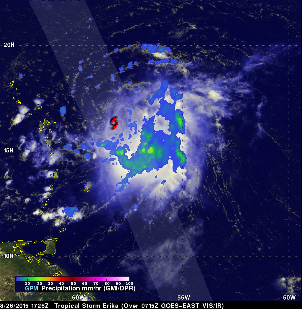
The images reveals that the low-level center of circulation (shown by the tropical storm symbol) is displaced well to the northwest of the storm's rain field, which contains areas of embedded convection (thunder storms) necessary strengthen and maintain the storm. However, for the storm to intensify, those areas of convection need to be located close to the storm's core, which is not the case here due to the effects of wind shear. At about the time of this image, the National Hurricane Center reported that Erika's maximum sustained winds were near 45 mph, making it a weak tropical storm, and that Erika was experiencing moderate northwesterly wind shear as it moved west near 17 mph.
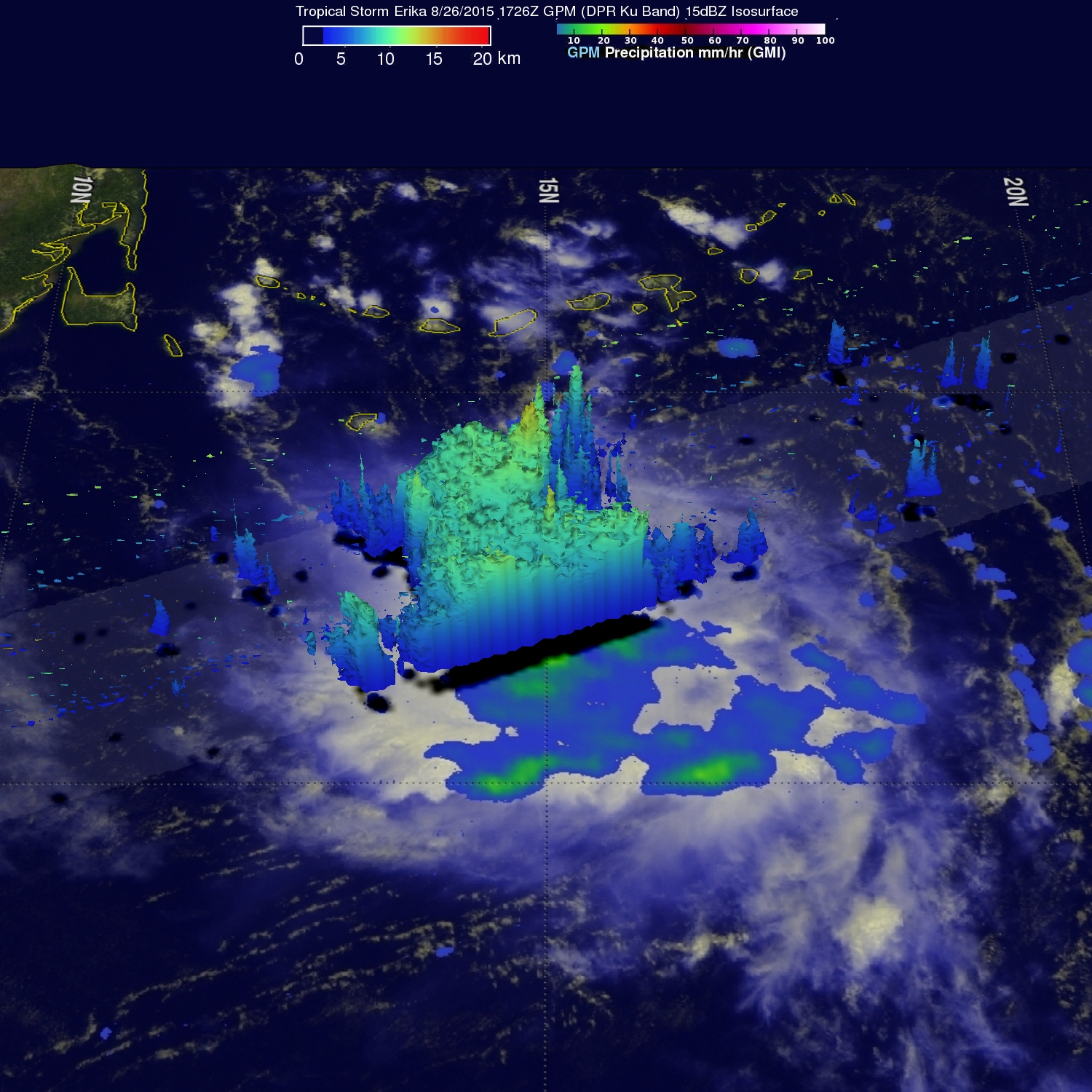
A 3D rendering of Erika taken at the same time by the GPM DPR (Dual-frequency Precipitation Radar) shows storm echo tops reaching to just over 14 km. Erika is forecast to pass near or over Puerto Rico within the next day as a tropical storm. Eventually conditions are forecast to become more favorable for development and Erika could become a hurricane as it nears the East Coast of Florida in about 4 days. GPM is a joint mission between NASA and the Japanese space agency JAXA.