
Powerful Hurricane Sandra Viewed By GPM
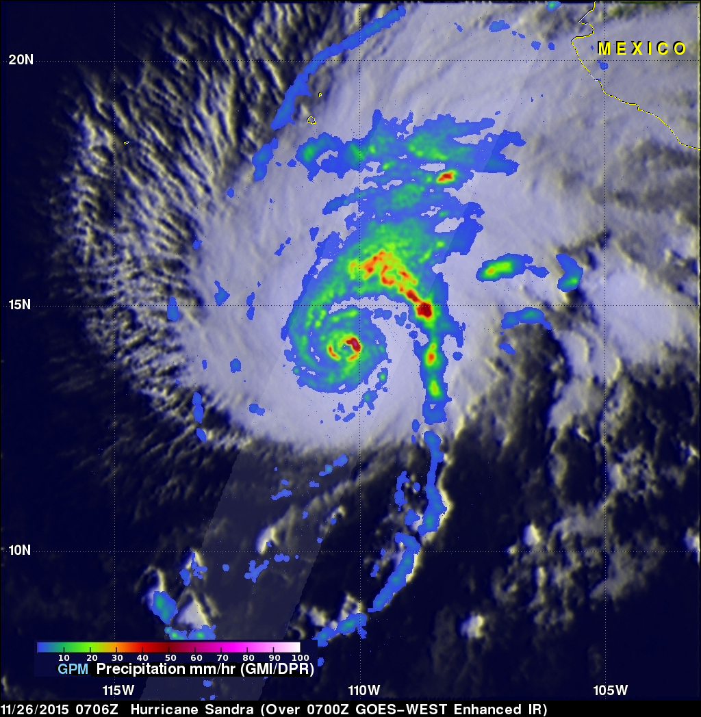
The GPM core observatory satellite flew above hurricane Sandra on November 26, 2015 at 0706 UTC. Sandra had winds of 125 kts (144 mph) at that time making it a category three on the Saffir-Simpson hurricane wind scale. This means that Sandra is the latest major hurricane ever recorded in the eastern Pacific Ocean. Numerous powerful hurricanes were predicted in the eastern Pacific Ocean at the beginning of the hurricane season due to the development of the 2015 El Nino. Data captured by GPM's Microwave Imager (GMI) and Dual-Frequency Precipitation Radar (DPR) instruments shows rain falling at a rate of almost 91 mm (3.6 inches) per hour on the northeastern side of Sandra's well defined eye wall.
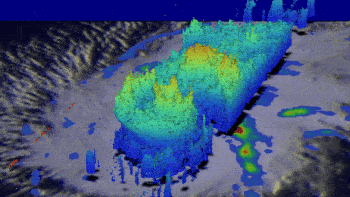
GPM's radar (DPR Ku band) data were used to show the 3-D structure of the precipitation within hurricane Sandra. Some powerful storms in Sandra's eye wall were reaching heights of over 14 km (8.7 miles). Even taller thunderstorms in a feeder band northeast of hurricane Sandra's eye were found pushing to altitudes of over 16 km (9.9 miles).
Vertical wind shear has started to weaken Sandra as the hurricane heads toward the Mexican coast. Sandra is predicted by the National Hurricane Center (NHC) to have weakened to a tropical depression before it hits Mexico's coast on November 28, 2015.