
GPM Sees Potential Atlantic Tropical Cyclone
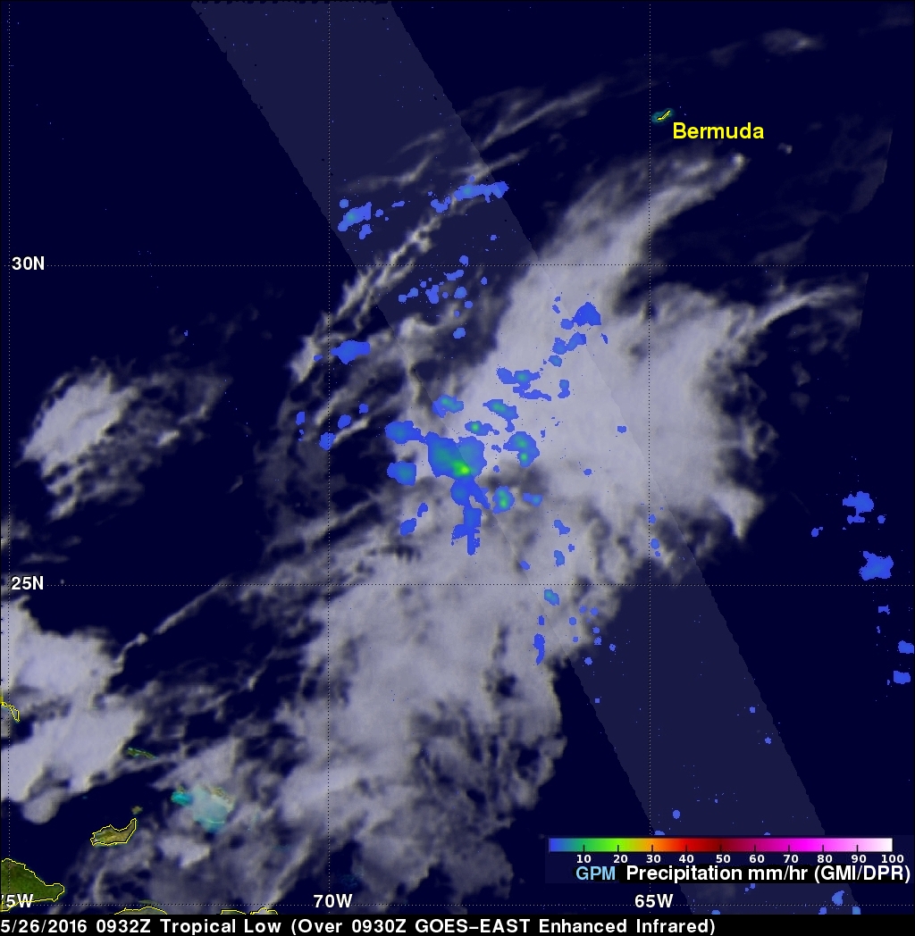
An area of low pressure located in the Atlantic Ocean between Bermuda and the Bahamas is being monitored today for possible development into a tropical or subtropical cyclone. Shower activity has increased in the area. The National Hurricane Center (NHC) has advised interests along the southeastern coast of the United States to monitor the progress of this low.
The GPM core observatory satellite flew over this showery area on May 26, 2016 at 0932 UTC (5:30 AM EDT). GPM's Microwave Imager (GMI) and and Dual-Frequency Precipitation Radar (DPR) instruments measured precipitation around the low. Rain was measured by GPM's radar (DPR) falling at a rate of amost 32 mm (1.3 inches) per hour in an area near the center of the low's circulation. Increasing shower activity near the center of a tropical low can signal tropical cyclone development. Tropical cyclones derive energy from the heat generated by condensation that occurs within showers and thundershowers.
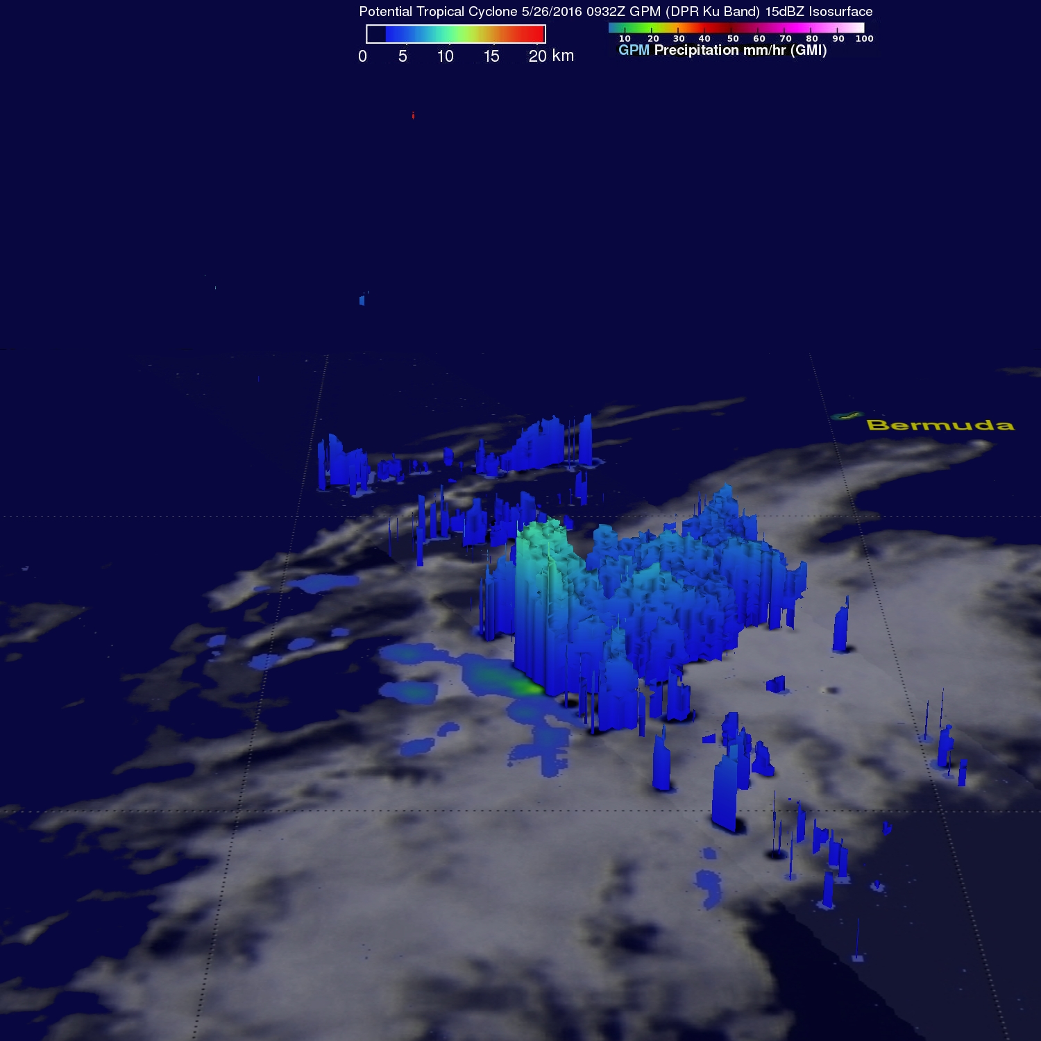
Date from GPM's DPR was used to the show the 3-D vertical structure of rainfall within the potential cyclone. Some storm top heights in an area of heaviest rainfall were found to reach heights of over 13 km (8 mile).