GPM Sees Halola Becoming A Typhoon
Satellite technology has the ability to see things we could never imagine, like how hard the rain is falling in storms, and how high cloud tops stretch into the atmosphere. The Global Precipitation Measurement (GPM) core observatory satellite does both of those things and has been providing that information each time it passes over Typhoon Halola in the Northwestern Pacific Ocean.
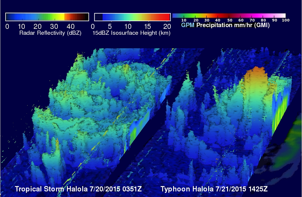
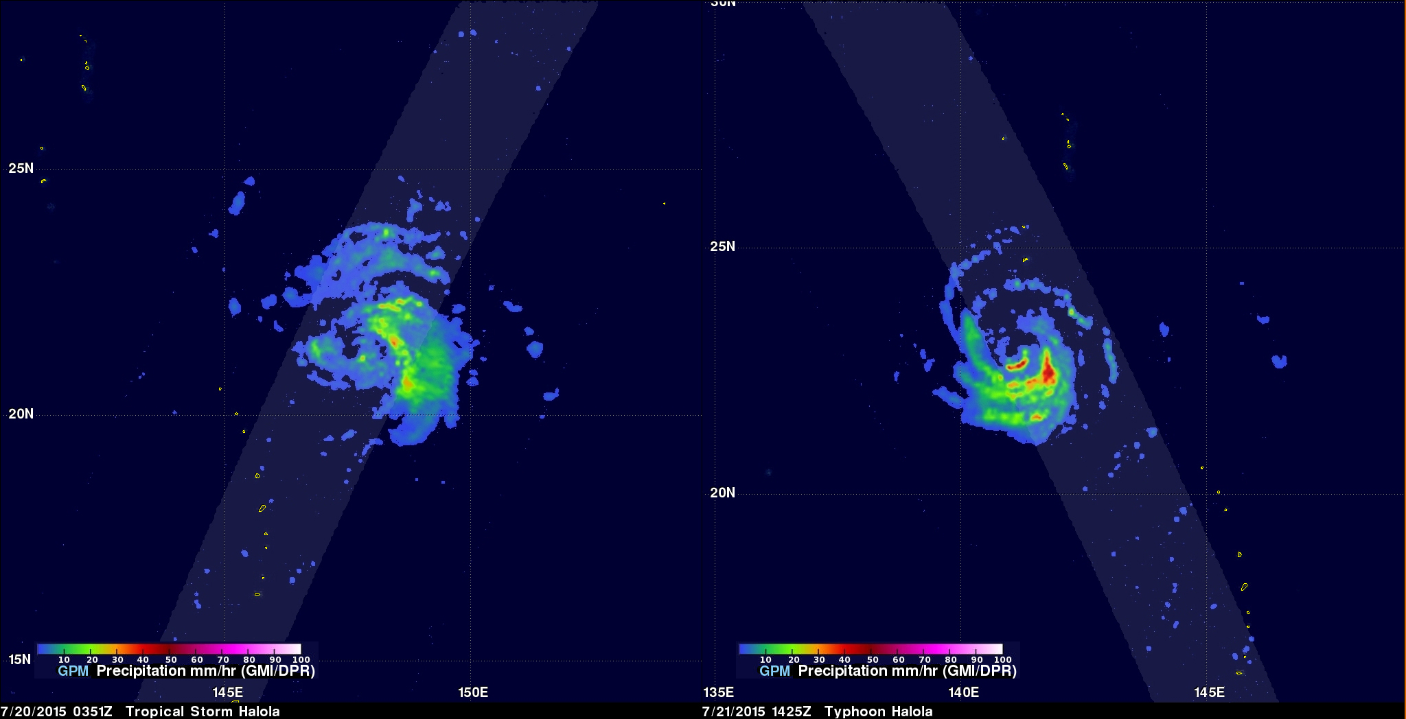
The GPM core observatory is a joint effort between NASA and the Japan Aerospace Exploration Agency. GPM saw Halola when it was strengthening from a tropical storm into a typhoon. GPM flew over Tropical Storm Halola on July 20, 2015 at 0351 UTC (July 19 at 11:51 p.m. EDT).
Then on July 21, 2015 at 1425 UTC (10:25 a.m. EDT) GPM saw Halola again as a typhoon. GPM saw the rate in which rain was falling within the storm using GPM's Microwave Imager (GMI) and Dual-Frequency Precipitation Radar (DPR) instrument (DPR). Those instruments revealed that the heaviest rain was falling at a rate of over 84 mm (3.3 inches) per hour.
At NASA's Goddard Space Flight Center in Greenbelt, Maryland, a simulated 3-D view of the storm was created using Ku band radar data. That 3-D view showed that the tall thunderstorm towers in Halola's eye wall had reached heights of over 17km (10.5 miles). These tall thunderstorms near the center of a typhoon release energy that can result in intensification.
Today, July 23 at 11 a.m. EDT, Halola's maximum sustained winds dropped to 85 knots (97.8 mph/157.4 kph) from 90 knots (103.6 mph/166.7 kph) just six hours It was centered near 24.7 North latitude and 133.8 East longitude, about 370 nautical miles (426 miles/685.7 km) east-southeast of Kadena Air Base, Okinawa, Japan. Halola was moving to the west-northwest at 7 knots (8 mph/12.9 kph).
Halola is now expected to track just west of the island of Kyushu on July 26 and curve to the northwest through the Sea of Japan.