
GPM Monitors New Tropical Storm Niala
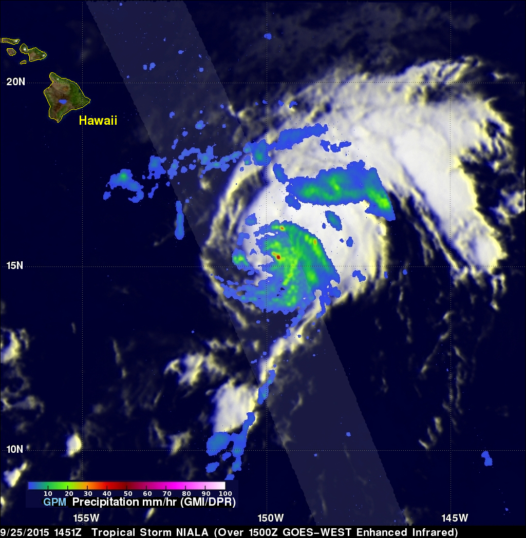
The GPM core observatory satellite flew directly above newly formed tropical storm NIALA (06C) on September 25, 2015 at 1451 UTC (4:41 AM HST). Rainfall data were collected by GPM's Microwave Imager (GMI) and Dual-Frequency Precipitation Radar (DPR) instruments showing that intense storms just northeast of NIALA's center of circulation were dropping rain at a rate of over 126 mm (4.96 inches) per hour. Another rain band wrapping around NIALA's northeastern side was found to contain rain falling at a rate of over 56 mm (2.2 inches) per hour.
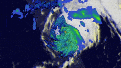
3-D radar reflectivity data collected by GPM's radar (DPR Ku band) were used to examine the vertical structure of tropical storm NIALA's precipitation. Simulated 3-D views around the tropical storm revealed that the intense storm just northeast of NIALA's center of circulation was pushing to heights above 16.3km (10.1 miles).
The Central Pacific Hurricane Center (CPHC) forecasts that tropical storm NIALA will intensify slightly but will curve to the west and pass south of the Big Island over the weekend. A flood watch was issued for Hawaii for the weekend.