GPM Has A Good Look At Tropical Storm Raquel
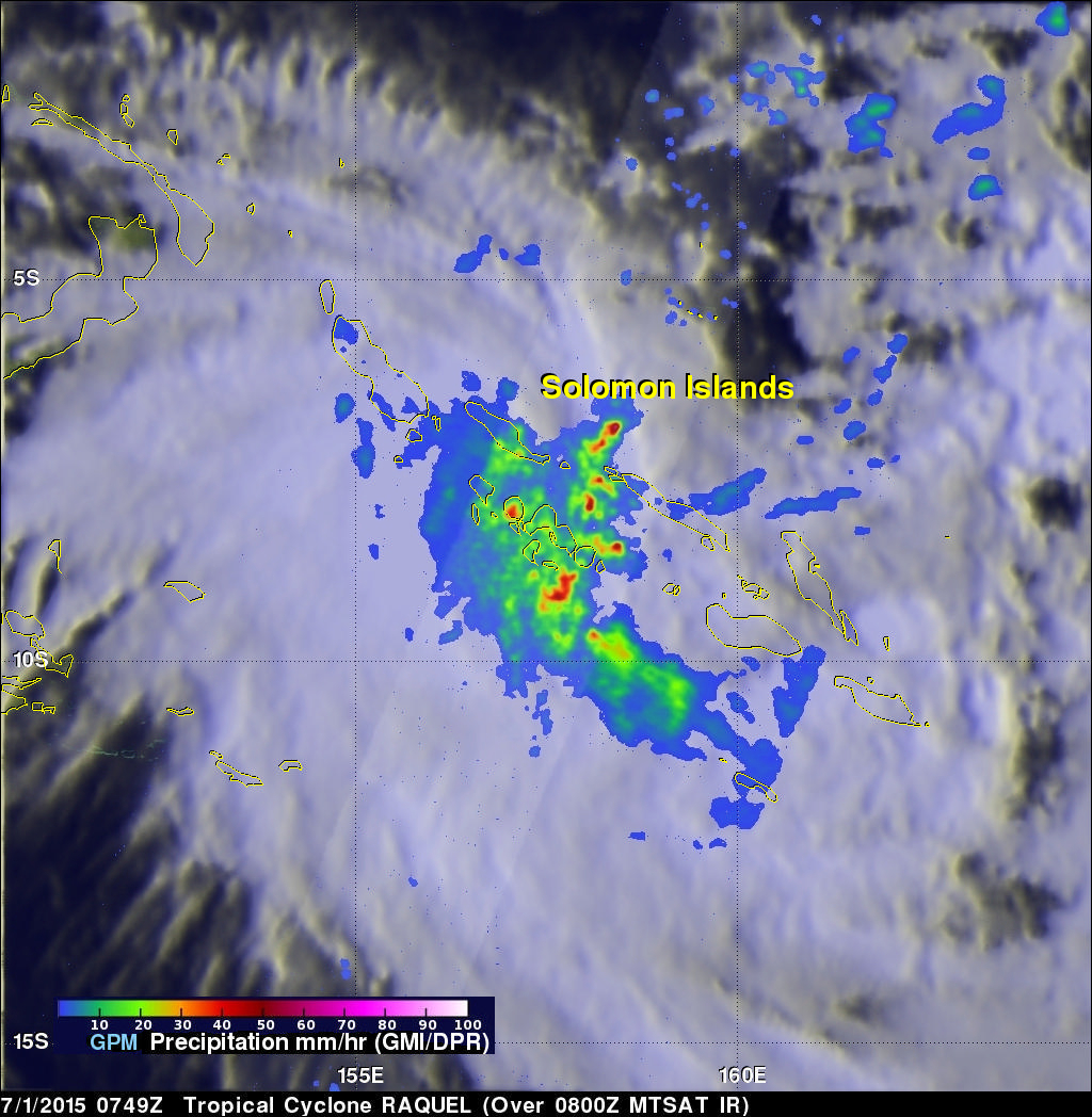
The GPM core observatory satellite recently had an excellent view of tropical storm Raquel in the South Pacific Ocean. Raquel was moving over the Solomon Islands on July 1, 2015 at 0749 UTC when viewed by GPM. Tropical cyclone activity normally ramps up in the northern hemisphere this time of the year so Raquel's development yesterday north of the Solomon Islands was a little surprising.
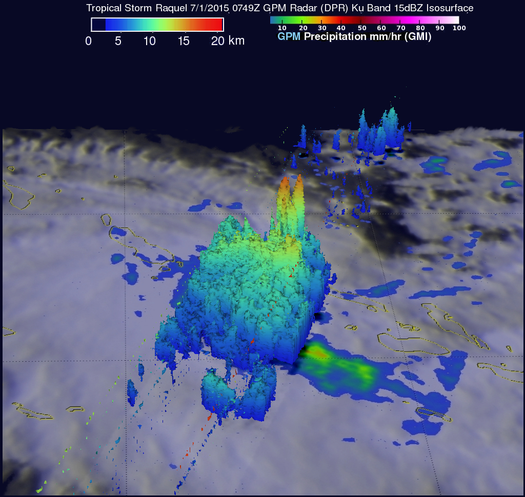
Rainfall was measured by GPM's Dual-Frequency Precipitation Radar (DPR) and Microwave Imager (GMI) instruments. Those data showed that powerful thunderstorms within Raquel were dropping rain at a rate of over 84 mm (3.3 inches) per hour in some areas. This simulated 3-D image was also constructed using GPM's DPR (Ku Band) radar reflectivity data. It was used to show the 3-D structure of rainfall within the tropical storm. Some of the tall thunderstorm located in Raquel's northern side were shown pushing to heights above 17 km (10.5 miles).


