GPM Has Another Good Look At Soudelor
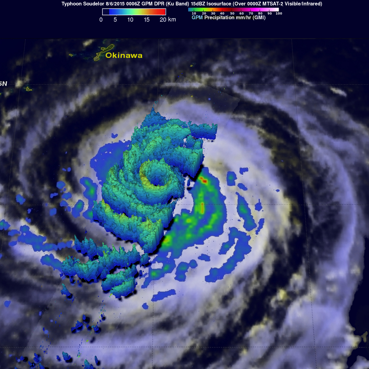
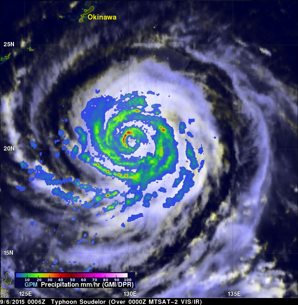
Typhoon Soudelor's winds had dropped to 95 kts ( 109 mph) when the GPM core observatory satellite had another excellent daytime view on August 6, 2015 at 0006 UTC. GPM's Dual-Frequency Precipitation Radar (DPR) data showed that Soudelor had heavy rainfall in an inner eye wall and also in a much larger replacement outer eye wall. The heaviest rain found by GPM was dropping at a rate of close to 70 mm (2.4 inches) per hour in a strong feeder band spiraling in on the southwestern side of the typhoon.
Radar reflectivity data from GPM's Dual-Frequency Precipitation Radar (DPR) data were also used in this image to show the vertical structure of rainfall within typhoon Soudelor. GPM found that the highest storm tops with Soudelor reaching heights of over 14.7 km (9.1 miles) were located in the powerful storms in the feeder bands southwest of the typhoon's eye.
The Joint Typhoon Warning Center (JTWC) predicts that typhoon Soudelor will intensify again and have winds of over 105 kts (121 mph) after an eye wall replacement cycle. Soudelor will be traveling over warmer ocean waters that are expected to add heat that boosts the wind speeds of the typhoon to 115 kts (132 mph) before hitting Taiwan tomorrow.