data products

IMERG Data Now in Giovanni-4

The NASA Goddard Earth Sciences Data and Information Services Center (GES DISC) has recently added all of the half-hourly and monthly *Final* IMERG data variables to the next generation of Giovanni, Giovanni-4 (G4). Giovanni is a Web-based application developed by the GES DISC that provides a simple and intuitive way for users to visualize, analyze, and access vast amounts of Earth science remote sensing data, without having to download the data. Learn more: http://disc.sci.gsfc.nasa.gov/gesNews/imerg_in_G4

Updated GPM Radiometer Products

The Precipitation Processing System (PPS) has begun producing updated GPM radiometer products as of 12/4/2014 due to an error discovered in the calculation of the Sun Angle in the PPS Geolocation Toolkit. This is considered a minor update with the Product Version being incremented in letter only. Please see the list of affected products here: http://pps.gsfc.nasa.gov/Documents/GPM_PPS_SunAngle_Products_20141204.p… For most radiometers the sun angle is used as ancillary information, but for the TRMM microwave imager (TMI) the correction also slightly impacts brightness temperature and
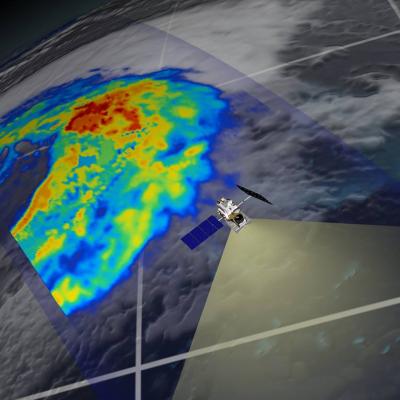
GPM flying over Earth with a data swath visualized.
Precipitation data sets, referred to as "products", are available at a variety of levels which denote the amount of processing that data has been through. These range from the raw instrument data to precipitation model outputs which are mathematically derived using the raw data as an input. Below are the definitions for each level: Level 0 Raw instrument data Level 1A Reconstructed, unprocessed instrument data at full resolution, time referenced, and annotated with ancillary information, including radiometric and geometric calibration coefficients and georeferencing parameters (i.e., platform...